Map of Guinea will help you in the study of the country located in western Africa and the Atlantic coast. Guinea-Bissau, Senegal, Mali, Cote d’Ivoire, Liberia and Sierra, Sierra Leone forms the boundaries of the country.
Blank Map of Guinea

Lower Guinea, the Fouta Djallon, Upper Guinea, and the Forest Region, or Guinea Highlands are the four regions in which the entire country’s landmass is divided. All four regions have their own linguistic groups. In Lower Guinea the major language is Susu, the Fouta Djallon region follows Pulaar, while in Upper Guinea the Malinke (Maninkakan) language is the most widespread in the regions. The Forest Region from east to west contains the linguistic areas, which belong to Kpelle (Guerzé), Loma (Toma), and Kisi.
Guinea Map with States:
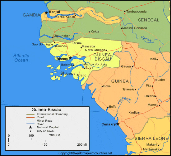
Guinea plays a major role in the drainage system of entire western Africa, more than 20 rivers originate from Guinea. Niger river with its tributaries flows from Upper Guinea to Mali. Senegal River and the Gambia are the other main rivers providing drainage systems.
Labeled Map of Guinea
Guinea follows the tropical climate which results in two alternating seasons a dry season which starts from November to March and a wet season from April to October. The country has plenty of natural resources with a large capacity of Hydroelectric potential. The country have also the reserves bauxite, iron, gold, and diamonds. But instead of all these economy is based on agriculture.
Printable Map of Guinea
The total population of the country is 1.28 crores of which 4/5th of the people are Sunni Muslims and Christian as minorities. Conakry is the national capital of Guinea which lies on Island Tombo and spreads up to the Camayenne (Kaloum) Peninsula, it is also the country’s main port.
These maps are user handy for every user, students search for maps on the internet on regular basis. We have provided pdf maps so that you can get help from these easily. Geography students always need blank maps for the practice of their learnings. If you are using the pencil for plotting the learning it will be more helpful and use those maps daily.
Guinea-Bissau from the northwest, Senegal to the north, mali from the northeast, Cote d’Ivoire from the southeast, and Liberia and Sierra and Sierra Leone from the south, and the


