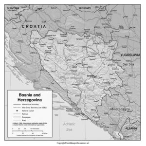
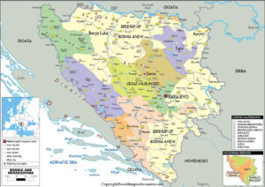
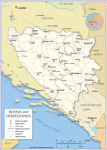
Download these Free Printable Labeled and Blank map of Bosnia and Herzegovina in PDF to learn about the very interesting, culturally diversified country. These maps are already labeled, and also a blank map for your practice. You will definitely get help with these maps in your studies. PDF formats are easily get printed and used for any further assistance or locating your topic of study about Bosnia and Herzegovina.
Blank Map of Bosnia and Herzegovina:

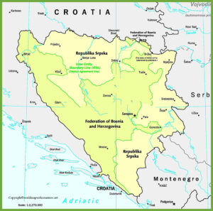
Bosnia and Herzegovina situated at the Balkan Peninsula of Europe and Located to the south of Croatia, west of Serbia, and north of Montenegro. Bosnia-Herzegovina is divided into the Federation of Bosnia-Herzegovina, and the Republic of Srpska.
Bosnia and Herzegovina Map with States:

Most of the ethnic Serbs live in the Republic of Srpska, and each side has its own capital. Sarajevo, for the Federation of Bosnia-Herzegovina, and Banja Luka for the Republic of Srpska, however Sarajevo acts as the national capital for the entire country as well.
the country is mostly mountainous or hilly as it lies on the Dinaric Alps in the Balkan Peninsula, with flatter lands in the north-east by the Pannonian Basin.
Labeled Map of Bosnia and Herzegovina:

About half the country is forested and about 30% of the land is arable, mostly in the north-east regions, whereas the south, mostly in Herzegovina, is more rocky and dry than the rest of the country.
The Danube near Croatia, the Bosna, Vrbas, and Una are the main drainage system of the country and merged to the Sava and get empty.
Printable Map of Bosnia and Herzegovina:

Bosnia Weather is generally mild-warm in July with 22 degrees Celcius and January is the coldest with 0 degrees. Meanwhile, the Herzegovina region has 26 degrees Celcius in summers and 6 degrees Celcius in winters.
60% of forest areas have pine, beech, and oak. Grapes, apples, pears, and especially plums are the most common fruits. You would like to know much more about this interesting country, so download these maps and go on.

