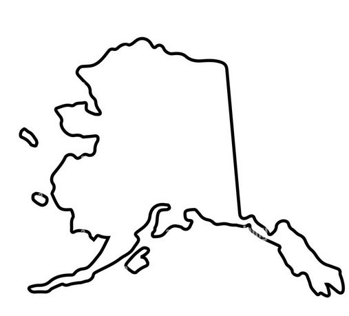
Alaska is the largest state in the United States and it has a unique geography that makes it a popular destination for tourists and adventurers alike. Whether you are planning a trip to Alaska or just want to learn more about this fascinating state, a good place to start is with an Alaska outline map.
Alaska Outline Map

An Alaska outline map is a blank map of Alaska that shows the state’s boundaries and major cities, but does not include any additional details such as rivers, mountains, or other geographic features. It is a simple, yet useful tool for anyone who wants to get a basic understanding of the state’s geography.
One of the most notable features of Alaska is its size. At over 660,000 square miles, it is larger than the next three largest states (Texas, California, and Montana) combined. Its size is reflected on any Alaska outline map, which will show a large area of land that stretches from the northernmost tip of North America to the Pacific Ocean.
The state’s vast size is due in part to its location in the far north. Alaska is the northernmost state in the U.S. and is located on the edge of the Arctic Circle. This location means that Alaska experiences long, dark winters and short, bright summers. It also means that much of the state is covered in snow and ice year-round, including the famous glaciers of Glacier Bay National Park and Preserve.
Another notable feature of Alaska is its coastline. Alaska has more coastline than any other state, with over 6,600 miles of shoreline. This includes the famous Inside Passage, a narrow channel that stretches from southeastern Alaska to Vancouver Island in British Columbia. The Inside Passage is a popular destination for cruise ships and offers stunning views of glaciers, fjords, and wildlife.
In addition to its coastline, Alaska is also home to a number of large rivers and lakes. The state’s largest river is the Yukon River, which stretches over 1,900 miles from its headwaters in Canada to the Bering Sea. Other notable rivers include the Kuskokwim, the Susitna, and the Copper River. Alaska is also home to some of the largest lakes in the country, including Lake Iliamna and Lake Clark.
Alaska’s geography is also shaped by its many mountains and volcanoes. The state is home to the tallest mountain in North America, Denali (formerly known as Mount McKinley), which stands at over 20,000 feet tall. Other notable peaks include Mount Foraker and Mount Hunter. Alaska is also home to a number of active volcanoes, including Mount Redoubt and Mount Augustine.
All of these geographic features can be seen on a detailed map of Alaska, but an Alaska outline map is a useful starting point for anyone who wants to get a basic understanding of the state’s geography. By looking at an Alaska outline map, you can see the state’s major cities, including Anchorage, Fairbanks, and Juneau, as well as its borders with Canada and the Pacific Ocean.
An Alaska outline map can also be used to explore the state’s different regions. Alaska is divided into five distinct regions: Southeast Alaska, Southcentral Alaska, Interior Alaska, Southwest Alaska, and the Aleutian Islands. Each region has its own unique geography, climate, and culture. For example, Southeast Alaska is known for its rainforests and abundant wildlife, while Southcentral Alaska is home to the state’s largest city, Anchorage, as well as the famous Kenai Peninsula.
If you are planning a trip to Alaska, an Alaska outline map can be a useful tool for planning your route. By looking at a map, you can see the different highways and roads that connect the state’s major cities and attractions. You can also use the map to get an idea of the distances between different destinations and how long it might take to travel between them.
In addition to its geography, an Alaska outline map can also give you an idea of the state’s political and administrative divisions. Alaska is divided into 19 organized boroughs and one unorganized borough, as well as several census areas. These divisions are shown on an Alaska outline map and can help you understand the state’s local government structure.
Finally, an Alaska outline map can also be a useful tool for educational purposes. Teachers and students can use the map to learn about Alaska’s geography, history, and culture. Students can label different cities, rivers, and mountains on the map, or use it to explore different regions of the state.
Overall, an Alaska outline map is a useful tool for anyone who wants to learn more about this fascinating state. Whether you are planning a trip to Alaska or just want to explore its geography from afar, a good place to start is with a blank map of Alaska. From there, you can begin to explore the state’s vast size, unique geography, and diverse regions.

